Detecting hotspots efficiently has become a critical challenge across industries, from wildfire prevention to infrastructure monitoring, requiring advanced technological approaches that combine multiple data sources.
🔥 The Urgent Need for Precision Hotspot Detection
The global demand for accurate hotspot detection has skyrocketed in recent years. Whether tracking forest fires, identifying thermal anomalies in industrial facilities, or monitoring volcanic activity, organizations need reliable methods to identify heat signatures before they escalate into disasters. The choice between satellites, drones, and ground sensors isn’t simply about technology—it’s about understanding which tool delivers maximum efficiency for specific scenarios.
Traditional detection methods often fell short, either arriving too late or providing insufficient detail for effective response. Modern hotspot mapping leverages multiple platforms simultaneously, creating comprehensive detection networks that minimize blind spots while maximizing response time. This multi-layered approach has revolutionized how we monitor and respond to thermal events across diverse environments.
🛰️ Satellite-Based Hotspot Detection: The Bird’s Eye Advantage
Satellite systems offer unparalleled coverage for hotspot detection, scanning vast territories that would be impossible to monitor through ground-based methods alone. NASA’s MODIS (Moderate Resolution Imaging Spectroradiometer) and VIIRS (Visible Infrared Imaging Radiometer Suite) have become industry standards, detecting thermal anomalies across continents in near-real-time.
The primary strength of satellite detection lies in its consistency and scope. These orbital platforms circle Earth multiple times daily, providing regular updates on thermal conditions across millions of square kilometers. For wildfire management agencies, this means early warning systems that can identify new ignitions within hours of their start, often before ground crews or local observers notice the smoke.
Technical Capabilities and Limitations
Modern fire-detection satellites operate in multiple spectral bands, particularly the mid-infrared and thermal infrared ranges where heat signatures are most visible. The European Space Agency’s Sentinel satellites, for instance, can detect temperature anomalies as small as 100 square meters when conditions are favorable.
However, satellite systems face inherent limitations. Cloud cover remains their most significant obstacle—thick smoke or weather systems can completely obscure thermal signatures. Temporal resolution presents another challenge; even with multiple satellites, revisit times typically range from 30 minutes to several hours, creating potential gaps in detection during rapidly evolving situations.
Spatial resolution varies considerably across satellite platforms. While high-resolution commercial satellites can achieve detail down to 3-5 meters, most operational fire-detection systems work at 375-1000 meter resolution. This means smaller hotspots, particularly in their initial stages, may go undetected until they’ve grown substantially.
🚁 Drone Technology: The Flexible Middle Ground
Unmanned aerial vehicles have emerged as powerful intermediaries between satellite observation and ground-based sensors. Drones equipped with thermal cameras and multispectral sensors can provide detailed hotspot mapping at a fraction of the cost of manned aircraft while offering far superior resolution to satellite systems.
The tactical advantage of drones lies in their deployability and adaptability. When satellites identify a potential hotspot, drones can be dispatched within minutes to provide detailed reconnaissance. This rapid response capability has proven invaluable for firefighting operations, allowing incident commanders to understand fire behavior, identify safe zones, and plan suppression strategies with unprecedented precision.
Thermal Imaging Capabilities
Modern firefighting drones typically carry thermal cameras operating in the 7.5-13 micrometer wavelength range, where heat signatures are most pronounced. These sensors can detect temperature differences as small as 0.05°C, revealing hidden hotspots beneath debris, identifying heat patterns in building fires, or tracking the precise edges of wildland fires.
Advanced drone platforms now integrate multiple sensor types simultaneously. A single flight might combine thermal imaging with high-resolution optical cameras, LiDAR for terrain mapping, and even gas sensors to detect specific combustion byproducts. This multi-sensor approach creates comprehensive situational awareness that far exceeds what any single detection method could provide.
Operational Constraints and Solutions
Despite their advantages, drones face operational limitations that must be carefully managed. Flight time remains a critical constraint—most commercial drones offer 20-40 minutes of operation before requiring battery changes or recharging. This limitation has driven innovation in tethered drone systems and automated battery swapping stations for extended missions.
Weather conditions significantly impact drone operations. High winds, heavy precipitation, and extreme temperatures can ground drone fleets precisely when they’re needed most. Regulatory restrictions in many jurisdictions also limit drone operations near populated areas, airports, or during nighttime hours, creating gaps in detection coverage.
Range limitations mean drones typically cover areas measured in square kilometers rather than the vast territories accessible to satellites. For large-scale monitoring operations, this necessitates multiple drone deployments or integration with other detection methods to maintain comprehensive coverage.
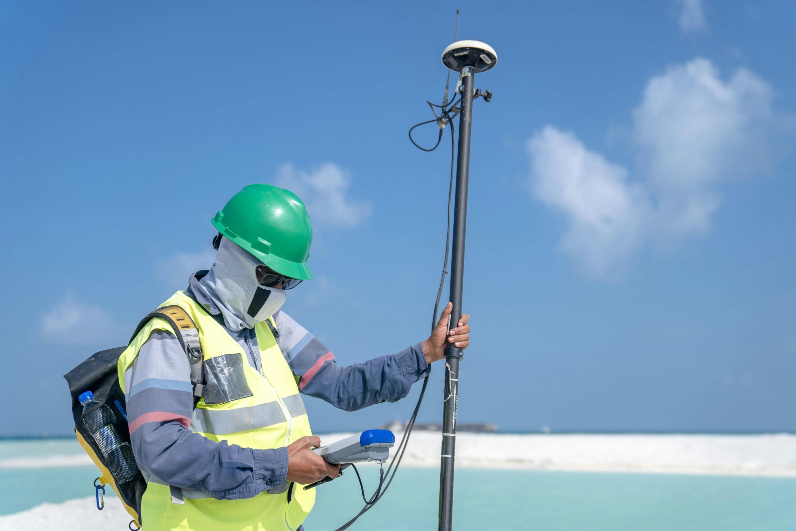
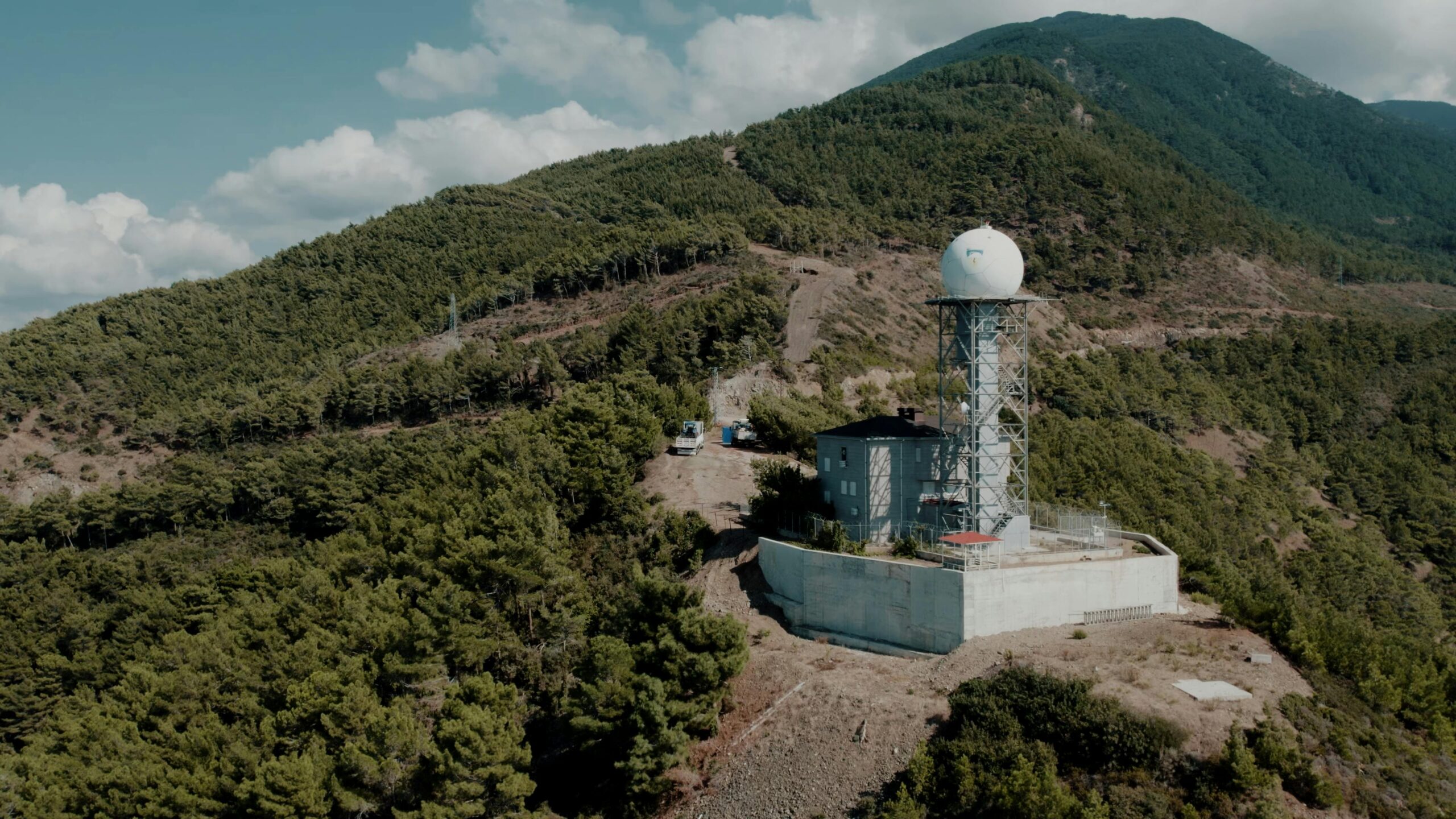
📡 Ground Sensors: The Detail-Oriented Approach
Ground-based sensor networks represent the most granular level of hotspot detection, providing continuous monitoring at specific high-value or high-risk locations. These systems range from simple temperature sensors to sophisticated thermal cameras mounted on towers or buildings, creating permanent observation posts that track conditions 24/7.
The California Alert California program exemplifies modern ground sensor networks, deploying over 1,000 cameras across wildfire-prone regions. These stations provide real-time visual and thermal monitoring, often detecting smoke plumes within minutes of ignition. Similar networks operate in Australia, Mediterranean countries, and other fire-prone regions worldwide.
Sensor Types and Applications
Ground-based thermal cameras offer several advantages over mobile platforms. Fixed positioning enables precise calibration and baseline establishment—the system learns normal thermal patterns for its coverage area, making anomaly detection highly accurate. Modern systems can automatically distinguish between legitimate hotspots and false positives like sun reflections or vehicles.
Distributed temperature sensing using fiber optic cables represents an innovative ground-based approach. These systems can monitor temperature along many kilometers of cable, detecting heat anomalies with meter-level precision. This technology has proven particularly valuable for monitoring infrastructure like pipelines, power transmission corridors, and tunnel systems.
Wireless sensor networks deploy multiple small, battery-powered temperature and humidity sensors across an area. These mesh networks communicate environmental data continuously, creating detailed microclimatic maps that reveal developing fire conditions before ignition occurs. Some systems incorporate smoke and gas sensors, providing multi-parameter monitoring for comprehensive threat assessment.
Coverage and Maintenance Considerations
Ground sensors excel at monitoring specific locations but provide inherently limited spatial coverage. A single camera tower might observe 10-20 square kilometers in optimal terrain—comprehensive coverage requires extensive networks with significant infrastructure and maintenance demands.
Environmental exposure poses ongoing challenges for ground-based systems. Dust, precipitation, temperature extremes, and wildlife can all degrade sensor performance or cause equipment failures. Vegetation growth may gradually obstruct camera views, requiring regular site maintenance. Power supply in remote locations often necessitates solar panels and battery systems, adding complexity and potential failure points.
⚖️ Comparative Analysis: Strengths and Weaknesses
Understanding when to deploy each detection method requires careful analysis of their respective advantages and limitations. No single approach provides optimal results across all scenarios—effective hotspot detection typically combines multiple methods in complementary ways.
| Detection Method | Coverage Area | Spatial Resolution | Temporal Resolution | Weather Dependency | Deployment Cost |
|---|---|---|---|---|---|
| Satellites | Continental | 30-1000m | 15min-12hrs | High (clouds) | Low operational |
| Drones | 1-100 km² | 0.05-0.5m | On-demand | Moderate | Medium |
| Ground Sensors | 0.1-20 km² | 0.01-1m | Continuous | Low | High installation |
Cost-Effectiveness Across Scales
Satellite data often represents the most cost-effective option for large-area monitoring. Many government agencies provide free or low-cost access to satellite hotspot data, making it accessible even to resource-limited organizations. The incremental cost of monitoring an additional thousand square kilometers is essentially zero once satellite infrastructure exists.
Drones occupy the middle ground economically. Initial hardware investments range from a few thousand to hundreds of thousands of dollars depending on capabilities, with ongoing costs for maintenance, training, and operations. For monitoring areas of 10-1000 square kilometers, drones often provide the best cost-per-square-kilometer performance, particularly when high-resolution data is required.
Ground sensor networks involve substantial upfront infrastructure costs but can provide excellent long-term value for monitoring specific high-risk areas. A comprehensive camera tower installation might cost $50,000-$200,000 but can operate for years with relatively modest maintenance expenses, providing continuous monitoring that no other method can match.
🔄 Integrated Detection Systems: The Future of Hotspot Mapping
The most sophisticated hotspot detection programs now employ integrated multi-platform approaches that leverage the strengths of each method while compensating for their weaknesses. These systems use satellites for broad-area screening, ground sensors for continuous high-priority monitoring, and drones for detailed investigation of detected anomalies.
Artificial intelligence and machine learning have become critical enablers of integration. Modern systems automatically analyze satellite data streams, identifying potential hotspots and triggering alerts for ground sensor review or drone deployment. Machine learning algorithms reduce false positives, learning to distinguish between legitimate thermal anomalies and benign heat sources like rocks, roads, or agricultural equipment.
Real-Time Data Fusion
Advanced detection platforms now integrate data from multiple sources in real-time, creating unified situational awareness. When a satellite detects a potential hotspot, the system automatically checks nearby ground sensors for corroborating data and can dispatch drones for verification if threshold criteria are met. This automated workflow dramatically reduces detection-to-response times.
Cloud-based processing enables sophisticated analysis that individual platforms couldn’t achieve independently. Satellite thermal data might be combined with weather forecasts, vegetation moisture content from ground sensors, and topographic data to predict fire spread—all before human operators even review the detection.
Communication and Coordination Challenges
Integrating diverse detection systems requires robust communication infrastructure and standardized data formats. Remote monitoring locations may lack reliable internet connectivity, necessitating satellite communications or cellular networks. Ensuring different sensor types can communicate effectively often requires custom integration work and ongoing technical support.
Data standardization remains an evolving challenge. Different satellites use varied spectral bands and calibration methods; drones may produce data in different formats depending on their sensor manufacturers; ground sensors often operate with proprietary protocols. Creating unified detection platforms requires translation layers that normalize these diverse data streams into comparable formats.
🌍 Industry-Specific Applications and Requirements
Different industries have distinct hotspot detection needs that favor particular technological approaches. Understanding these sector-specific requirements helps optimize detection strategy selection.
Wildfire Management
Wildfire agencies typically employ all three detection methods in tiered approaches. Satellites provide the broad screening layer, identifying new ignitions across entire regions. Ground-based camera networks monitor high-risk areas during extreme fire weather. Drones support active incidents, providing tactical intelligence for firefighting operations and post-fire assessment.
The temporal dynamics of wildfire detection drive technology choices. Early detection—within the first few minutes of ignition—offers the best suppression opportunities, favoring ground sensor networks in strategic locations. However, the unpredictability of ignition locations means satellites remain essential for comprehensive coverage despite their temporal limitations.
Industrial Facility Monitoring
Refineries, chemical plants, and power generation facilities often favor ground-based thermal imaging networks supplemented by periodic drone surveys. The fixed nature of infrastructure assets makes permanent sensor installation cost-effective, while the high consequence of missed detections justifies redundant monitoring systems.
Industrial applications often require higher temperature detection thresholds and different alert criteria than wildfire monitoring. Systems must distinguish between normal operational heat signatures and genuine anomalies, requiring sophisticated baseline modeling and machine learning approaches to minimize false alarms while maintaining sensitivity to actual problems.
Agricultural Applications
Precision agriculture increasingly uses thermal monitoring to detect irrigation problems, plant stress, and disease outbreaks. Drones have become the preferred platform for farm-scale monitoring, offering the flexibility to survey different fields on rotating schedules while providing sufficient resolution to identify individual plant rows or even specific stressed plants.
Satellite thermal data supports regional agricultural monitoring, particularly for drought assessment and large-scale crop health evaluation. The lower resolution is acceptable for these applications, while the consistent coverage enables temporal analysis that reveals developing problems over days or weeks.
💡 Maximizing Efficiency: Strategic Implementation Guidelines
Implementing an effective hotspot detection program requires careful analysis of your specific needs, available resources, and operational environment. These guidelines help optimize technology selection for maximum efficiency.
- Define detection objectives clearly: Specify required detection thresholds, acceptable response times, and coverage requirements before selecting technologies.
- Assess existing infrastructure: Evaluate available power, communications, and physical infrastructure that might support ground sensor networks.
- Consider operational capacity: Ensure your organization has the personnel, training, and resources to effectively utilize selected technologies.
- Plan for integration: Design systems with data sharing and interoperability in mind, even if initially deploying single platforms.
- Budget for the complete lifecycle: Include training, maintenance, upgrades, and eventual replacement in cost calculations, not just initial acquisition.
- Validate detection accuracy: Implement testing protocols to verify actual detection performance matches specifications and expectations.
- Establish response protocols: Detection without effective response provides little value—ensure alert systems connect to appropriate action workflows.
Scaling Strategies for Growing Programs
Many organizations benefit from phased implementation approaches that begin with readily accessible technologies and expand as capabilities mature. Starting with free satellite data services establishes baseline monitoring with minimal investment. Success with satellite detection often justifies investment in ground sensors for high-priority locations, followed eventually by drone capabilities for detailed investigation.
This scaling approach also builds organizational capacity progressively. Staff gain experience with remote sensing concepts through satellite data interpretation before moving to more operationally demanding drone or ground sensor programs. Training investments align with capability expansion, avoiding the waste of sophisticated training for systems not yet deployed.
🚀 Emerging Technologies and Future Directions
Hotspot detection technology continues evolving rapidly, with several emerging capabilities poised to enhance efficiency further. Small satellite constellations promise dramatically improved temporal resolution—companies like Planet Labs operate fleets of dozens of satellites that can image locations multiple times daily rather than every few days.
Artificial intelligence advances are making automated detection increasingly reliable. Neural networks trained on millions of thermal images can now identify hotspots with accuracy rivaling or exceeding human analysts while processing data streams far too large for manual review. This enables truly autonomous monitoring systems that alert humans only when verified threats are detected.
Autonomous drone systems represent another frontier. Battery technology improvements, automated charging stations, and enhanced AI enable drones that can patrol designated areas without human intervention, landing only for recharging or when weather conditions require. These systems promise continuous aerial monitoring that bridges the gap between satellites and ground sensors.
Sensor miniaturization continues creating new deployment possibilities. Temperature sensors now exist in packages smaller than a coin, powered by energy harvesting from solar, thermal, or even radio frequency sources. These developments enable massively distributed sensor networks at costs and scales previously impossible, potentially transforming hotspot detection in the coming decade.
The convergence of these technologies into unified, AI-driven detection platforms will likely define the next generation of hotspot monitoring systems. Organizations that begin building integrated, multi-platform capabilities now position themselves to leverage these advances as they mature, maximizing detection efficiency while minimizing costs across their operational lifespans.